|
Some adjustments are required for the forecast. Beginning with Wed.
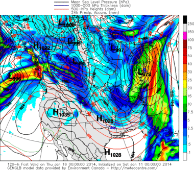
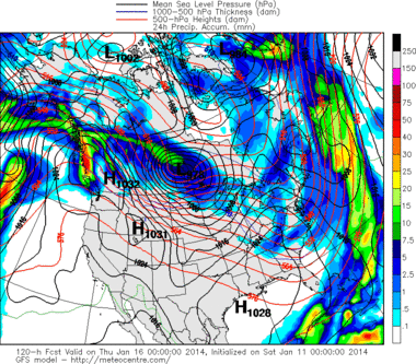
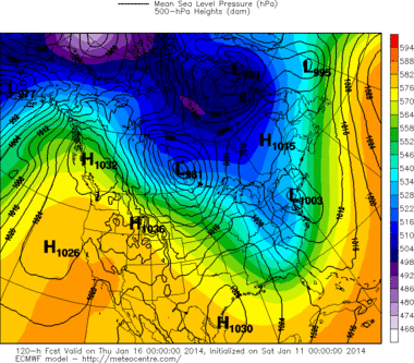
Wednesday: Cloudy. Some light rain/snow showers at night. High: 40. Low: 30. Thursday: Clouds and sunshine. Windy. High: 36. Low: 20. Friday: Cloudy. Maybe some light snow. High: 34. Low: 25. Saturday: Chilly with clouds and sun. Snow ending? High: 35. Low: 21. Sunday: Cold. Increasing clouds with some snow showers possible toward evening. High: 306 Low: 25. Happy Weekend Folks: A foggy dreary morning. The snow is melting, heavy rain and warm temps are on the way as expected. Temps should peak this evening … after dark! This cold dank air will be scoured out steadily throughout the day. Temps will slowly fall during the night to just below 40 by morning. One mistake models make is rushing the cold air in too fast. We are east of the mountains. Simple physics comes into play: west winds flowing over and down the mountains dry out and warm up. So our air will dry out first and then slowly cool down. Sun-Mon: the easy part of the forecast. Trough lifts out and it stays mild as another is building to our west. Tue-Wed: Hardest part of the forecast. Strong front comes through Tue, bringing us back to reality. Trough to be established for the rest of the week. Much colder, but could it snow and accumulate on Wed? Some rain will accompany the front, but what happens behind for Wed is a tough call. It would seem that some accumulating snow is likely, but how much? You can see below how different the models are at this point (and this is better agreement than 24 hours ago!) The Canadian GEM has heavy snowstorm for us Wed; the middle pic is of the GFS which has nothing; and the last pic is of the ECMWF which has a low sitting over Allentown giving us a healthy to heavy snow as well. Fun, fun, fun to forecast. (From http://meteocentre.com/models. Great site!) Thu-Fri: Colder. It should be windy as well. Some light snow is possible on Fri but not a big deal at this time.
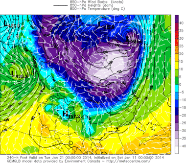
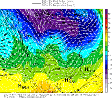
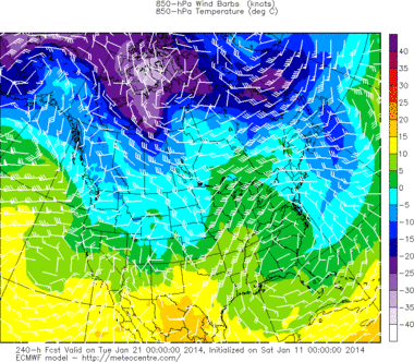
Sat-Sun: Calmer, cold but the chill easing. Weather should be ok, but maybe some wintry stuff arriving late in the weekend. Specifics: Today: Cloudy, foggy early, rain arriving. Heavy rain likely this afternoon and evening. Watch out for local flooding and ice jams. Becoming very warm. Highs in the upper 50s. Low: 39. Sunday: Blustery with sunshine and passing clouds. High: 44. low: 28. Monday: Mostly sunny and very nice. Warm with highs near 52. Increasing clouds at night. Low: 34. Tuesday: Cloudy with a period of rain early; high: 44. Low: 28. Wednesday: Cloudy with some snow. Expect at least a couple of inches. Colder. High: 32. Low: 24. Thursday: Clouds and sunshine. Windy. High: 32. Low: 20. Friday: Windy and colder. Maybe some light snow. High: 28. Low: 15. Saturday: Cold with sun and clouds. High: 28. Low: 14. Sunday: Cold. Increasing clouds with some snow possible toward evening. High: 30. Low: 25. Hint for the following Week: Take a look at the disagreement into the models for the following week: (Orange is very warm, and white is bitter cold). So what do you want? Visit from the polar vortex on the left? Temporary thaw in the middle? Big thaw on the right? Polar vortex visit is too fast, but will probably try to return by the last week of the month. So the middle option is probably closer to reality.
0 Comments
Leave a Reply. |
AuthorPastor Terry. He received his bachelors degree in Meteorology from the State University of New York at Oneonta, in 1994. The education continued as a hobby by reading the blogs of some of the best forecasters in the business. Although forceasting the weather is an imperfect science, it is a pleasure to follow what the Creator has made. Categories |

 RSS Feed